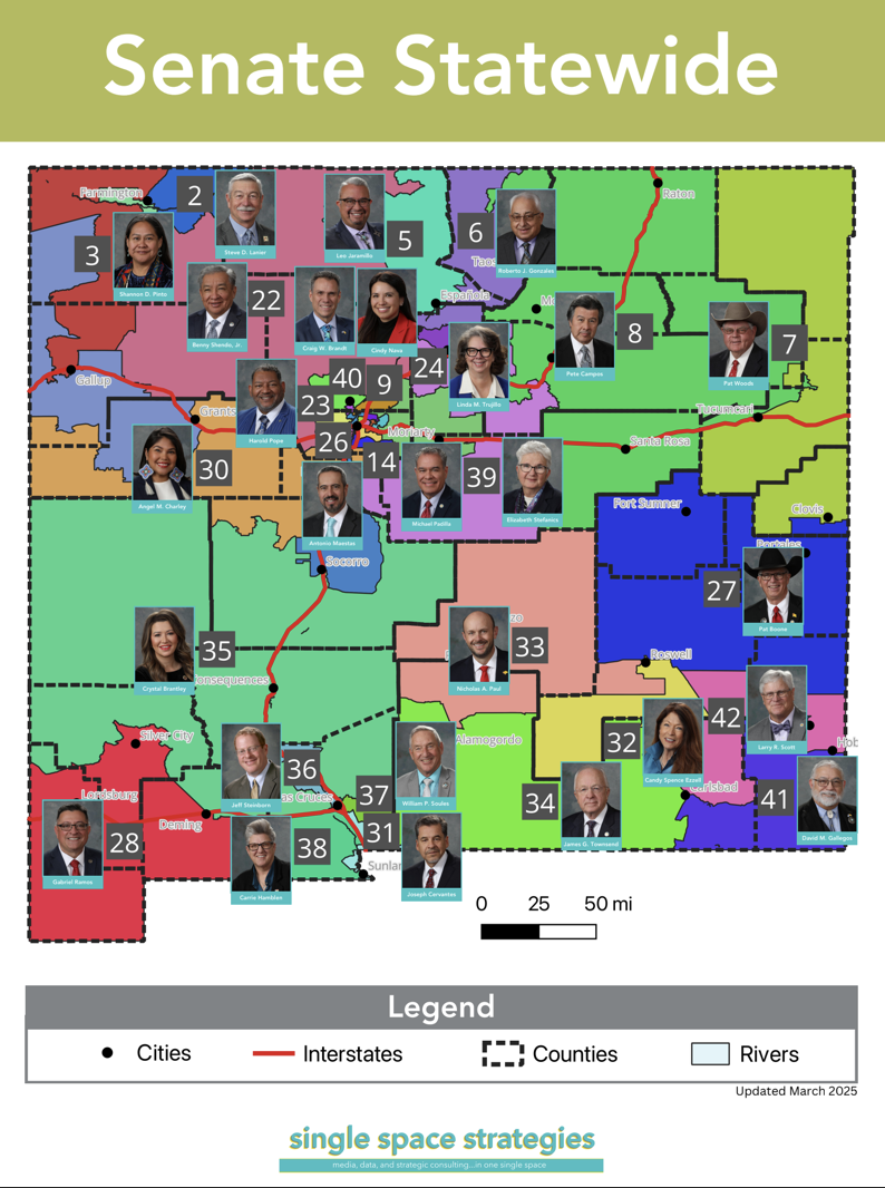
2025 Legislative Maps
In support of our partners that work on legislative policy, we put together updated legislative district maps for general use.
Legend:
Black dots represent cities.
Red lines represent interstate highways.
Light blue areas represent rivers.
Counties are outlined in dotted black borders.
House Maps

Senate Maps